
OEM: Blizzard Warning
A Blizzard Warning is now in effect for the area from 1:00 PM Sunday, February 22 through 6:00 PM Monday, February 23.
What to expect
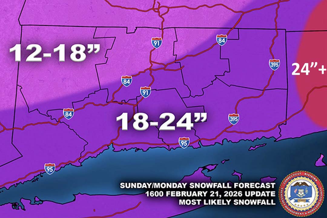
Heavy snow, 18–24+ inches possible across southern Fairfield County. Snowfall rates over 2" per hour during the heaviest snowfall. Strong winds gusting 45–70+ mph. Blowing snow creating near-zero visibility and true blizzard conditions.
Extremely dangerous travel and risk of power outages. Due to the extreme winds, power restoration will take longer and may result in prolonged outages.
Unlike the large storm several weeks ago, this snow will be very heavy, plan accordingly for snow removal. Frequent breaks are recommended.
Prepare now – quick checklist
- Charge phones & devices + have backup chargers/batteries.
- Stock up on water, non-perishable food, medications & flashlights.
- Keep a full gas tank or charged EV.
- Check on elderly neighbors and family.
- Have blankets, warm clothing, and a battery-powered radio ready.
- Generators must be operated outdoors and away from doors and windows.
Town updates & resources
Road plowing and salting operations will begin Sunday. Please give plows plenty of space and do not park on town roads.
Sign up for emergency alerts (Everbridge) here.
Follow Westonct OEM on Facebook for real-time updates.
Non-emergency Police and Fire: (203) 222-2600.
Only use 911 for true emergencies.
Remember to treat all downed wires as live and stay away from them. Report power outages directly to Eversource at 1-800-286-2000.
Travel is not advised during the storm. Stay safe, stay warm, and stay informed.
The Weston Emergency Management team is monitoring the situation closely and is fully prepared to respond.